- Tags:
- Bruhnes-Matsuyama reversal / Chiba / Chibanian / geological era / geology / geomagnetic reversal / Global Boundary Stratotype Section and Point / GSSP / International Union of Geological Science / magnetic field / Motonori Matsuyama / outcropping / river banks / stratum / Yoro River
Related Article
-
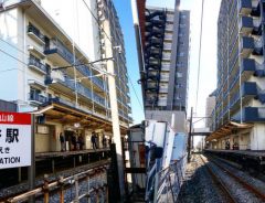
Japanese Apartment Building With Train Station On First Floor Is Either Most Convenient Or Most Annoying
-
Top 30 Travel Destinations In Japan Chosen By International Travelers
-

Japanese Farmers Deploy New Terrifying ‘Super Monster Wolf’ Robot Scarecrow
-
A Memorable Excursion to Idyllic Takataki Lake – Part 2: Scenic Walk, Museum and Shrine
-

Chiba Travel: Tokyo Doitsu Mura Winter Illumination 2019-2020
-

A hidden gem in Japan: Mother Bokujo Farm in Chiba- A place for all ages


Chibanian!
Despite its similarity to the name of a certain cat-ghost from the anime Yo-Kai Watch, Chibanian is a serious academic matter and an issue of pride for Japanese people, particularly those living in Chiba Prefecture. Along the banks of the Yoro River in a quiet part of the countryside in the Boso Peninsula, there is a cliff where Japanese geologists discovered a stratum providing evidence of the geological time period, from 770,000 to 126,000 years ago, when the most recent reversal of the Earth's magnetic fields occurred.
In a first screening process, Chibanian, the proposed name of the age assigned in honor of the Prefecture where the stratum was discovered, beat out the name "Ionian" representing two stratum sites in Italy. Although the International Union of Geological Science is expected to render its final decision on the name by the end of this year, the scientific community unanimous expects Chibanian to be adopted, thus becoming the first time a Japanese place name is used for a geological time period and Japan's first Global Boundary Stratotype Section and Point (GSSP).
To access the Chibanian site, you should take the quaint local Kominato Line, which is, as we previously reported, a pleasant adventure by itself. From Goi Station, board the Kominato Line and get off at Tsukizaki Station. A free shuttle leaves from Tsukizaki Station at 1:30 pm、1:55 pm and 2:22 pm and leaving from the site at 2:07 pm、2:34 pm、3:12 pm and 3:30 pm. The shuttle only runs on weekends, so you'll need to walk about a half hour from the station if you're visiting on a weekday.
You'll know you're getting close when you see this fork in the road. Take the left road going up the hill
Source: © Grape Japan
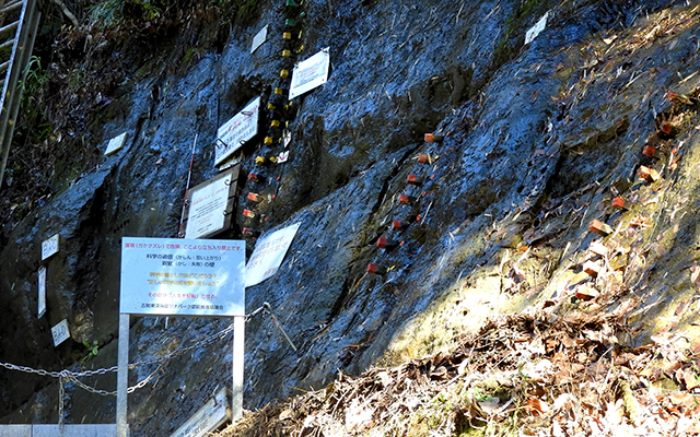
When you arrive, and begin to walk on the trail leading to the site, you'll see several signs explaining the scientific and historical significance of the site. This sign explains the phenomenon of geomagnetic reversal which was discovered by Motonori Matsuyma in 1929, the Brunhes-Matsuyama reversal 781,000 years ago which was the most recent example, and the evidence thereof at the current site.
Source: © Grape Japan
Source: © Grape Japan
You are invited to take leaflets providing more information (in Japanese).
Source: © Grape Japan
After walking for another five minutes, and negotiating a small rocky slope (appropriately-soled shoes are advisable), you'll arrive at the banks of Yoro River. Unfortunately, when we visited, the site of the original find (circled in yellow) was not accessible due to construction work. A few people slipped and injured themselves, so they are building stairs which you can see in the picture here. When the stairs will be completed, the area should reopen.
Source: © Grape Japan
As you can see, they take safety very seriously.
Source: © Grape Japan
Although the original site is not directly accessible, you can see the stratum very well, the cliff pockmarked with holes where samples were taken, and markings indicating the various points demarcating the stratum.
Source: © Grape Japan
Source: © Grape Japan
Source: © Grape Japan
Also, the river is very peaceful and apparently quite pleasantly cool during the hot and humid summer months.
Source: © Grape Japan
When Chibanian is officially approved, you can expect even more visitors to flock to the area, so if you can, take advantage of it this year while it's still relatively uncrowded.
Your visit to the site makes a nice addition to a day excursion in the Boso Peninsula, for example to idyllic Lake Takataki, as we reported earlier this month.